Before Google Earth and other satellite imaging services, park maps were the only logistical way to see a “bird’s-eye view” of an amusement park. Park maps have differed in their appearance over the years, and we are compiling some of our favorites for you to see.
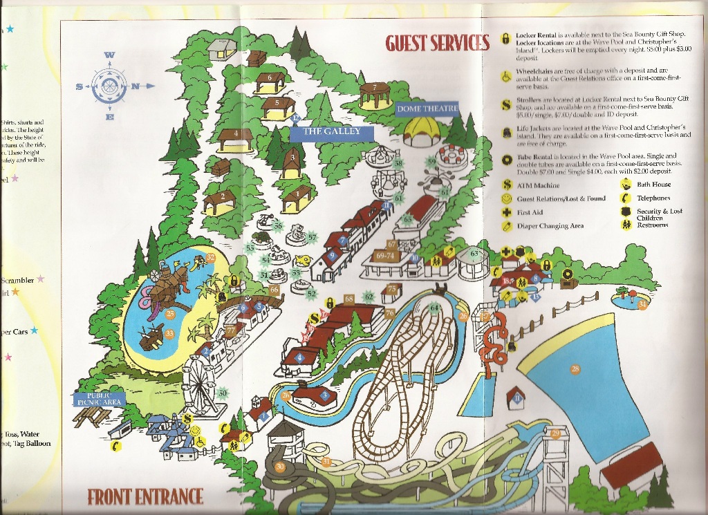
Up first we have a Wyandot Lake park map from 2002. At this time in history, the park was operated by Six Flags, although it never adopted the Six Flags name. The park has now been reconfigured as Zoombezi Bay and Jungle Jack’s Landing, a part of the Columbus Zoo and Aquarium.
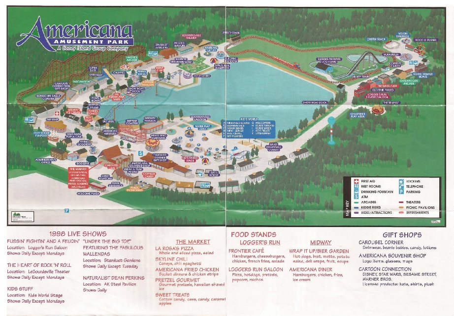
Next, we have an American Amusement Park map from 1998. The park was originally known as LeSourdsville Lake Amusement Park but was renamed Americana Amusement Park in 1977. The park closed in 1999, but much of the park’s remains still exist. The Screechin’ Eagle roller coaster was demolished in 2011.
Click here to see even more park maps on our Facebook page. We’ll be adding to the gallery, so check back often. Have old park maps of your own? Feel free to share them on our Facebook wall.


That’s cool!
Thanks Roller Coaster Rider!